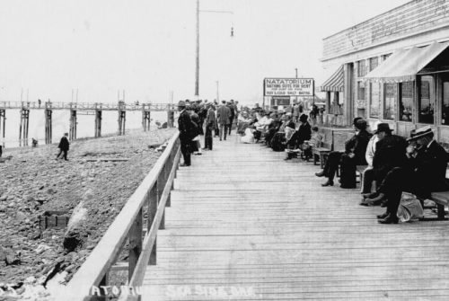
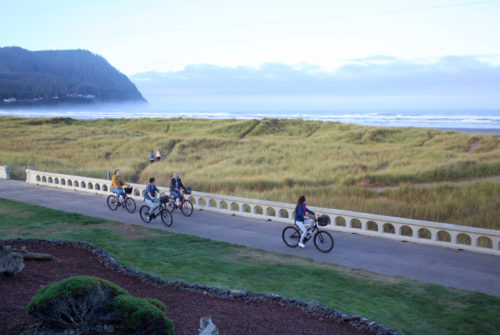
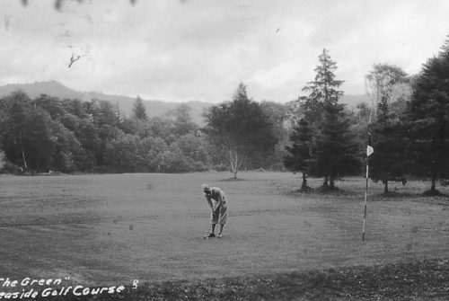
Biking in Seaside

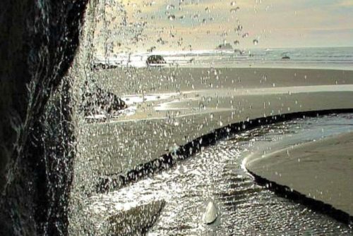
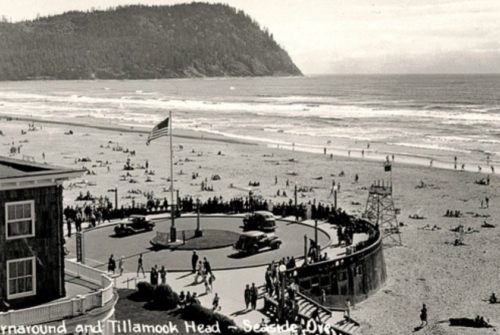
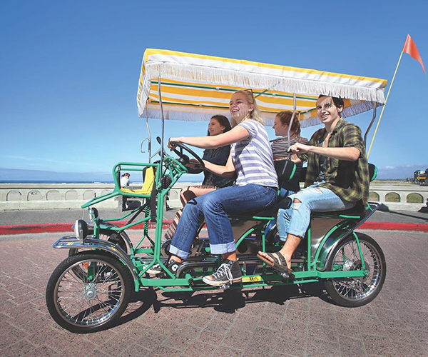
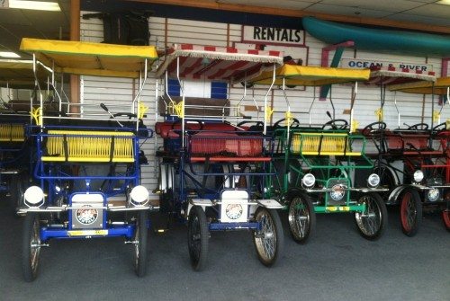
Riding leisurely through quiet streets on either side of Broadway or along the 1.5 mile oceanfront Promenade are the main ways visitors enjoy Seaside on two wheels. The more adventurous take on the challenging trails in the hills above Seaside, which are owned by timber companies. You can find groomed trails for all ages (and the remains of the largest Sitka spruce in Oregon) at Klootchy Creek.

Jump to...

Biking in #SeasideOregon

  • How To Bike Seaside in Every Season

    If you like to ride a bike, there’s something for everyone in Seaside and something for every season, too. Seaside’s trails and roads, paved and otherwise, have you covered. Here are some great biking experiences recent visitors have enjoyed in and around Seaside.

    GET INSPIRED
  • Prom Bike Shop

    For all your bike rental needs, as well as repairs and sales.

    VISIT THE WEBSITE
  • Wheel Fun Rentals

    Specialty cycles, bike rentals and beach wheelchairs.

    VISIT THE WEBSITE

Biking Trails of Seaside

Understand Seaside's mountain biking rules and trail etiquette. Download PDF.

Crown Camp Loop

  • TRAIL DISTANCE

    5.6 miles

  • ELEVATION GAIN

    424 ft.

  • Maximum elevation

    750 ft.

  • Difficulty

    Easy

Trail Description

This is a good short route to try before attempting longer and more difficult routes. The ride route circles the office and shop area which is all that remains of the small logging town site of Crown Camp. After following the Lewis and Clark Mainline a short distance the route turns onto the 300 Mainline and makes a steady but moderate climb for about 2 miles to an unmarked crossover road. The route then follows the crossover road making a steep descent to the Lewis and Clark Mainline and follows the Lewis and Clark Mainline back to the entry gate. The ride route provides some good views of Saddle Mountain and the Lewis and Clark River valley. The lower portion of the crossover road descends into a canyon with a year round creek and a small dam that can be seen on the right side.

The Ride

Ride past Entry Gate number 71 on Lewis and Clark Road. If the gate is closed, go around the left gate post and ride straight ahead on the paved road .6 miles and past a chain link fenced area on the right side. Just past the fenced area turn right onto the gravel road and ride through or around Gate 73. This is the start of the 300 Mainline. Begin climbing following the well-traveled 300 Mainline. There are several stretches of old pavement in the first mile.

  • At 1.6 miles the 300 Mainline veers to the left at a main intersection. Turn left and ride past the 1 mile sign continuing on the 300 Mainline.
  • At 2.6 miles turn left onto the unmarked side road. Keep to the right past two intersecting side roads.
  • At 2.9 miles take the left fork and continue to follow the crossover road keeping left at all intersecting roads to the Lewis and Clark Mainline. Turn left onto the Lewis and Clark Mainline and ride 1.6 miles back to the entry gate.

Technical

Ride Time: 45 minutes. Climbs at an average 4.9% grade for 1.9 miles on 300 Mainline. Descent from 300 Mainline to Lewis and Clark Mainline has one steep section. Lower portion of crossover road tends to become overgrown in summer. Expect truck traffic on 300 Mainline and Lewis and Clark Mainline during weekdays.

More [...]

500 Mainline and Cullaby Creek

  • TRAIL DISTANCE

    6.3 miles

  • ELEVATION GAIN

    403 ft.

  • Maximum elevation

    365 ft.

  • Difficulty

    Easy

Trail Description

This is another good route to try before attempting longer and more difficult routes. The ride route starts at Entry Gate 72 on the north side of Lewis and Clark Road across from the parking area. The route follows the Lewis and Clark Mainline a short distance to the 500 Mainline. The route then follows the 500 Mainline climbing a low hill and passing the Warrenton Water Plant before reaching Airplane Crossover Road. There are several nice views of the coast along the 500 Mainline. Following Airplane Crossover, the route descends to Cullaby Creek, passes through a pretty canyon and then climbs out of the canyon to a junction with the Lewis and Clark Mainline. Following the Lewis and Clark Mainline, the route returns to the entry gate.

The Ride

Cross Lewis and Clark Road heading north and follow the Lewis and Clark Mainline 0.1 mile to Entry Gate 72. Go through or around the entry gate on the left and continue on the Lewis and Clark Mainline less than 0.1 mile to the 500 Mainline. Turn left onto the 500 Mainline and go through or around Gate 69. Continue on the 500 Mainline.

  • At 1.5 Miles pass the Warrenton water plant on the left.
  • At 2.5 miles turn right onto Airplane Crossover.
  • Follow Airplane Crossover descending to Cullaby Creek at 3.5 Miles.
  • Continue on Airplane Crossover to Gate 109 and the intersection with the Lewis and Clark Mainline at 4.3 Miles.
  • Turn right onto the Lewis and Clark Mainline and ride 2.0 miles back to the entry gate.

Technical

Ride Time: 45 minutes. Several short, moderate climbs and descents. Route may become overgrown in summer months beyond the Warrenton water plant. Expect weekday truck traffic on the Lewis and Clark Mainline.

More [...]

Lewis & Clark Mainline (Upper)

  • TRAIL DISTANCE

    Lewis & Clark Mainline (Upper)

  • ELEVATION GAIN

    721 ft.

  • Maximum elevation

    936 ft.

  • Difficulty

    Moderate

Trail Description

The route is an extension of Seaside Visitor Bureau Mountain Bike Route 1, The Lewis and Clark Mainline. Beginning at the turn-around point for Route 1, the route continues to follow the Lewis and Clark Mainline to its intersection with Saddle Mountain Road. Beyond the turn-around point for Route 1, the original road was washed out in a flood forcing a 2-mile detour higher up the side of the canyon. This portion of the route includes a moderately steep climb and descent. The final 2.5 miles resumes a gentle climb to Saddle Mountain Road. The combined routes offer two options to riders. They can be done as a 22-mile round-trip loop beginning and ending at the Entry Gate 71 at Lewis and Clark Road. They can also be done as an 11-mile one-way ride by arranging for a pick up at Lewis and Clark Mainline Entry Gate 57 at Saddle Mountain Road which is accessible by car. The route provides some pretty views of the Coast Range Mountains including the north side of Humbug Mountain. There is a pleasant view of the Lewis and Clark River from a small bridge just off of the Lewis and Clark Mainline at Bridge 11 Road.

The Ride

If you are tracking your distance traveled from Entry Gate 71 at Lewis and Clark Road, add 6.9 miles to the mileage points on this route. Beginning at the turn-around point for Ride Route 1, follow the Lewis and Clark Mainline making a turn to the left to a steep, 1-mile climb followed by a steep 0.6-mile descent. Keep to the right at all of the intersecting roads until you have reached the bottom of the descent.

  • At 1.8 miles reach the intersection with Bridge 11 Road on the right. A short distance from the Lewis and Clark Mainline on Bridge 11 Road there is a small bridge with a nice view of the Lewis and Clark River. Continue on the Lewis and Clark Mainline keeping to the right at all of the intersecting roads to Entry Gate 57 at Saddle Mountain Road.
  • At 4.1 miles go through or around Entry Gate 57 and ride a short distance across a bridge to reach Saddle Mountain Road. Follow the same route back to return to the turn-around point for Ride Route 1.

Technical

Ride Time: 1 hour. Steep climbs and descents on rough gravel road surface. Expect truck traffic during weekdays. Climbs at an average grade of 6% for 1 mile. Descends at an average grade of -7% for 0.6 mile. Climbs at an average grade of 2% for remaining 2.5 miles to the turn-around point. Climbs and descents are reversed on return.

More [...]

300 Mainline, 306/305 Loop

  • TRAIL DISTANCE

    8 miles

  • ELEVATION GAIN

    800 ft.

  • Maximum elevation

    1,085 ft.

  • Difficulty

    Moderate

Trail Description

After going a short distance south on the Lewis and Clark Mainline, the route turns and follows the 300 Mainline west and south climbing about 700 feet in 3 miles. The route then turns onto and follows the 306 Road north along the ridge with great views of the south end of Seaside including the Cove and Tillamook Head. After a short, steep climb to the high point, the route becomes the 305 Road. There is no sign to indicate where this happens. The 305 Road offers great views of the north end of Seaside all the way to Clatsop Spit and the Mouth of the Columbia River. Following the 305 Road, the route descends and returns back to the 300 Mainline. The route then follows the 300 Mainline retracing its route to the Lewis and Clark Mainline and back to the entry gate.

The Ride

Ride past Entry Gate number 71 on Lewis and Clark Road. If the gate is closed, go around the left gate post and ride straight ahead on the paved road .6 miles and past a chain link fenced area on the right side. Just past the fenced area turn right onto the gravel road and ride through or around Gate 73. This is the start of the 300 Mainline. Begin climbing following the well-traveled 300 Mainline. There are several stretches of old pavement in the first mile.

  • At 1.6 miles the 300 Mainline veers to the left at a main intersection. Turn left and ride past the 1 mile sign continuing on the 300 Mainline. The steep road to the right at 1.9 miles is the 305 Road. The ride route descends this road to return to the 300 Mainline. Continue on the 300 Mainline.
  • At 3.85 miles turn right onto the 306 Road and ride past the 306 road sign. Stay on the 306 Road as it climbs up and over the high point and becomes the 305 Road. Several unmarked spur roads intersect the 306 and 305 roads but are less traveled and lead to dead ends a short distance from the route.
  • At 5.9 miles the 305 Road makes a short but steep and technical descent to the 300 Mainline.
  • At 6.1 Miles turn left onto the 300 Mainline. Follow the 300 Mainline back down the hill passing through Gate 73 to the Lewis and Clark Mainline. Turn left onto the Lewis and Clark Mainline to return to the entry gate.

Technical

Ride Time: 1 hour. Moderate climbs. Average 4% grade for 3 miles on 300 Mainline. Average 8% grade for 0.3 mile on 306/305 Loop. Several steep descents. The 306/305 Loop is lightly traveled and can become rough due to erosion. This is particularly true on the short, steep descent to the 300 Mainline. The loop follows the top of a ridge and is exposed to strong winds. It is not unusual for fallen trees to block the route following strong windstorms. Expect weekday truck traffic on the 300 Mainline and Lewis and Clark Mainline.

More [...]

Little South Fork

  • TRAIL DISTANCE

    13 miles

  • ELEVATION GAIN

    1,250 ft.

  • Maximum elevation

    1,482 ft.

  • Difficulty

    Moderate

Trail Description

After a short distance on the Lewis and Clark Mainline the route turns onto the 300 Mainline and begins a long but gradual climb. After topping the ridge due east of Seaside’s Avenue U, the route continues climbing to follow the 300 Mainline south along the ridge for several miles crossing into Beerman Creek Canyon. Turning northeast, the route then heads towards Davis Point and the Little South Fork Canyon. At a 4-way intersection the route takes the Little South Fork Crossover Road and crosses into the Little South Fork Canyon. After climbing the final 70 feet to the 1,482 foot high point, the route loses most of its elevation gain in a steep, 2.5 mile plunge to the bottom of the Little South Fork Canyon. The route then follows the Little South Fork to the Lewis and Clark Mainline crossing a single lane bridge and passing by a small dam along the way. Following the Lewis and Clark Mainline, the route returns to the entry gate.

The Ride

Go through or around Entry Gate number 71 on Lewis and Clark Road and ride straight ahead on the paved road 0.6 mile and past a chain link fenced area on the right side. Just past the fenced area turn right onto the 300 Mainline and ride through or around Gate 73.

  • At 1.6 miles veer left, ride past the 1 mile sign and continue on the 300 Mainline.
  • At 3.9 miles, the 300 Mainline reaches the top of the ridge and the intersection with the 306 Road. Continue on the 300 Mainline.
  • At 5.6 miles keep left on the 300 Mainline at the intersection with the 320 Road.
  • At 6.2 miles keep left on the 300 Mainline at the intersection with the Klootchy Crossover Road.
  • At 6.5 miles the 300 Mainline goes to the right. Ride straight ahead onto the Little South Fork Crossover Road passing the LSFXO sign.
  • At 7.2 miles the Little South Fork Crossover reaches the ride’s high point, makes a sharp turn to the right and begins a steep descent.
  • Continue on the Little South Fork Crossover, descending and reaching the canyon bottom at 9.9 miles.
  • At 10.7 miles, ride through Gate 60 and turn left onto the Lewis and Clark Mainline. Ride 2.3 miles on the Lewis and Clark Mainline passing through Gate 75 to return to the entry gate.

Technical

Ride Time: 1.5 hours. Moderate exertion. Continuous, 6-mile climb at an average grade of 4%. Steep, 2.5-mile descent at an average grade of -8.5%. The steep descent on the Little South Fork Crossover Road may be slightly technical depending on vehicle traffic and road conditions. In wintertime, higher elevations can become icy and snow packed. Expect truck traffic on the 300 Mainline and the Lewis and Clark Mainline during weekdays.

More [...]

300 Mainline, Beerman Creek, Necanicum Mainline Loop

  • TRAIL DISTANCE

    15.2 miles

  • ELEVATION GAIN

    1,605 ft.

  • Maximum elevation

    1,283 ft.

  • Difficulty

    Moderate

Trail Description

After a short distance on the Lewis and Clark Mainline the route turns onto the 300 Mainline and begins a long but gradual climb. After topping the ridge due east of Seaside’s Avenue U, the route continues climbing to follow the 300 Mainline south along the ridge for another 1.5 miles crossing into Beerman Creek Canyon. The route then makes a steep descent into Beerman Creek Canyon. At the bottom of the canyon, the route turns onto the Necanicum Mainline and climbs to the top of a low ridge. After cresting the ridge, the route makes a short descent to the 300 Mainline and follows the 300 Mainline back down the hill to the intersection with the Lewis and Clark Mainline. Following the Lewis and Clark Mainline, the route returns to the entry gate. The route presents many great views of Seaside and the North Coast.

The Ride

Go through or around Entry Gate number 71 on Lewis and Clark Road and ride straight ahead on the paved road 0.6 mile and past a chain link fenced area on the right side. Just past the fenced area turn right onto the 300 Mainline and ride through or around Gate 73.

  • At 1.6 miles veer left, ride past the 1 mile sign and continue on the 300 Mainline.
  • At 3.9 miles, the 300 Mainline reaches the top of the ridge and the intersection with the 306 Road. Continue straight ahead on the 300 Mainline.
  • At 5.6 miles turn right onto the 320 Road. Climb to the ride high point and follow a sweeping descent and curve to the right. Keep to the right at the intersecting road at 6 miles.
  • At 6.2 miles, take the unsigned right fork at the 4-way intersection. This is the NEC 60 Road. Follow the Nec 60 Road for 2.5 miles as it makes a steep descent into Beerman Creek Canyon.
  • At 8.7 miles, reach a 3-way intersection with the Necanicum Mainline. The road straight ahead exits through Gate 76 and intersects Hwy 101 in 1.5 miles. Turn right and Follow the Necanicum Mainline for 5.7 miles to the intersection with the 300 Mainline. About a quarter of a mile before it meets the 300 Mainline, the Necanicum Mainline becomes the Necanicum Crossover however the route does not change.
  • At 13.4 miles, go straight ahead onto the 300 Mainline. Follow the 300 Mainline down the hill for about 1 mile passing back through Gate 73.
  • At 14.6 miles, turn left onto the Lewis and Clark Mainline and follow the Lewis and Clark Mainline back to the entry gate.

Technical

Ride Time: 2 miles. Moderate exertion. Continuous, 5-mile climb on the 300 Mainline at an average grade of 4%. Steep, 2.9-mile descent into Beerman Creek Canyon at an average grade of -7%. More gradual 4.5-mile climb on the Necanicum Mainline at an average grade of 2%. The descent into Beerman Creek Canyon has several steep pitches which require caution due to loose rock. Otherwise the route does not present any significant technical challenges. Expect truck traffic on the 300 Mainline and the Necanicum Mainline during weekdays.

More [...]

200 Mainline, 450 Road, 400 Mainline Loop

  • TRAIL DISTANCE

    12. 5 miles

  • ELEVATION GAIN

    1,178 ft.

  • Maximum elevation

    1,158 ft.

  • Difficulty

    Moderate

Trail Description

Important Notice: The 400 Mainline Loop is currently an active logging operation and riders should use extreme caution, possibly even avoiding this route, as equipment may be blocking the road. This notice will be updated once operations cease.

The route follows the Lewis and Clark Mainline crossing 3 bridges and passing by a small dam and fish ladder. After turning onto the 200 Mainline the route climbs to the top of a ridge overlooking the Lewis and Clark River Valley and the North Coast. The route levels out and continues following the 200 Mainline for about 2 miles along the ridge with a sweeping view from Tillamook Head to the Columbia River. Turning onto the 450 Road, the route appears to go over a cliff. It’s not that bad, but it does descend over 600 feet in less than a mile with the steepest part just below the 200 Mainline. Following the 400 Mainline for about 2.5 miles, the route crosses a bridge over a small creek and passes by an interesting cave before reaching the Lewis and Clark River. After crossing the Lewis and Clark River Bridge, the route continues on the 400 Mainline another mile making a moderate climb and passing through Gate 72 before returning back to the Lewis and Clark Mainline just inside of Entry Gate 71.

The Ride

Go through Entry Gate number 71 on Lewis and Clark Road and ride straight ahead on the paved road past an office and shop area at 3/4 miles on the right. Continue through gate 75 just past the buildings. If the gate is closed go around the gate on the right side. Stay on the well-traveled road for 3.6 miles crossing three one-lane bridges and passing the Warrenton water supply dam and fish ladder on the right just past the third bridge.

  • At 3.6 miles turn left onto the 200 Mainline and ride past the “200” road sign.
  • At 4.7 miles, keep right at the intersection with the 270 Road.
  • At 5.5 miles, keep right at the intersection with the 217 Road.
  • At 5.9 miles, keep left at the intersection with the 260 Road and continue following the 200 Mainline as it climbs to the top of the ridge. At 8.3 miles, turn left onto the 450 Road, ride past the “450” road sign and begin a steep descent. At 9.1 miles, turn left onto the 400 Mainline. Follow the 400 Mainline for 2.3 miles to the Lewis and Clark River Bridge crossing a small bridge and passing by a small cave on the left side of the road just past the bridge.
  • At 11.4 miles, continue on the 400 Mainline, crossing the Lewis and Clark River Bridge and climbing out of the canyon.
  • At 12.4 miles, pass through Gate 72, turn right onto the Lewis and Clark Mainline and ride about 100 yards back to Entry Gate 71.

Technical

Ride Time: 1.5 hours. Moderate. 2.8 mile climb on the 200 Mainline at an average grade of 4.5%. Steep descent on the 450 Road at an average grade of -13.5%. 0.7 mile climb at an average grade of 3.8% from the Lewis & Clark River Bridge to the Lewis & Clark Mainline. The descent from the 200 Mainline to the 400 Mainline on the 450 Road is steep with loose rock and gravel. Caution is advised. Otherwise, the route does not present any significant technical challenges. Expect weekday truck traffic on the Lewis and Clark Mainline.

More [...]

Davis Point Summit

  • TRAIL DISTANCE

    3.2 miles

  • ELEVATION GAIN

    484 ft.

  • Maximum elevation

    1,900 ft.

  • Difficulty

    Hard

Trail Description

This route is a side trip adding 3.2 miles and 484 feet of elevation gain to The Little South Fork Crossover, Ride #5. It should only be attempted by experienced riders looking for a more challenging ride. The climb to the summit will give most riders an opportunity to spin those big gears on the rear cassette. The view from the summit makes the effort worthwhile. On a clear day some of the peaks of the Cascade Range are visible as well as the mountains on the Olympic Peninsula to the north. The sheer face of Saddle Mountain looms to the east with a panoramic view of the north coast to the west. The small shed on the summit is a working radio relay station. Do not enter, climb on, or otherwise disturb the building or antenna equipment.

The Ride

Follow the route of Ride #5, The Little South Fork Crossover to the 3-way junction at 6.5 miles.

  • Turn right at the junction and continue to follow the 300 Mainline, bearing left at the intersection with the 325 Road (unsigned).
  • At 0.9 miles from the junction, turn left onto Spur Road 326 (unsigned) and ride through Gate 64.
  • Follow Road 326 to the summit keeping to the left at the intersecting spur roads.
  • Follow the same route back to the 3-way junction.
  • At the junction, turn right onto the Little South Fork Crossover Road to follow the remainder of the Ride #5 route adding 3.2 miles to the mileage points on the route beyond the 3-way junction.

Technical

Ride Time: 30 minutes. Difficult. Average grade of 9% for 0.6 mile from the 300 Mainline to the summit. The climb from the 300 Mainline to the summit is steep with some moderately technical sections. Most challenging is the last 0.1 mile which is a climb up a 20% grade over loose rock. Maintaining rear wheel traction in this section is difficult. The descent through this section is equally challenging.

More [...]

321 Spur Road

  • TRAIL DISTANCE

    1.75 miles

  • ELEVATION GAIN

    297 ft.

  • Maximum elevation

    1,666 ft.

  • Difficulty

    Hard

Trail Description

This route is a side trip adding 1.75 miles and 297 feet of elevation gain to The Little South Fork Crossover, Ride #5. It should only be attempted by experienced riders looking for a more challenging ride. While the climb is moderately steep, the real challenge of this route is the poor condition of the road. At one point the road seems to disappear into some small trees. Don’t give up. In about 100 feet, the road opens up again with a short climb to the summit. The panoramic view of Seaside and the North Coast is worth the effort. The route stops at a nice viewpoint and then returns over the same route back to the 300 Mainline.

The Ride

Follow the route of Ride #5, The Little South Fork Crossover to the 3-way junction at 6.5 miles.

  • Turn left at the junction onto Spur Road 321.
  • Keep left at the first spur road intersection.
  • Keep right at the second spur road intersection.
  • At 0.7 miles the route reaches the high point.
  • At 0.87 mile the route turns around and follows the same route back to the 300 Mainline.
  • The spur road continues and is rideable for about another 0.5 mile beyond the turn-around point.
  • Follow the same route back to the 3-way junction.
  • At the junction, turn left onto the Little South Fork Crossover Road to follow the remainder of the Ride #5 route adding 1.75 miles to the mileage points on the route beyond the 3-way junction.

Technical

Ride Time: 20 minutes. Difficult. Average grade of 7% for 0.7 mile with two short, steep climbs in excess of 10%. The road is not maintained and has become rough and overgrown in places. However, with some determination, an experienced rider can push their way through the small trees and achieve the summit.

More [...]

Twin Peaks

  • TRAIL DISTANCE

    4.8 miles

  • ELEVATION GAIN

    754 ft.

  • Maximum elevation

    1,506 ft.

  • Difficulty

    Hard

Trail Description

This route is a side trip adding 4.8 miles and 754 feet of elevation gain to the 300 Mainline, Beerman Creek, Necanicum Mainline Loop, SVB Ride #6. It should only be attempted by experienced riders looking for a more challenging ride. The Twin Peaks are the two prominent hills visible looking south from Seaside. They are located near the junction of Hwy 101 and Hwy 26. The route follows a primitive road to the summit of the western twin. The climb is tough, but the view is fantastic. There is currently no known route to the summit of the higher, east twin.

The Ride

Go through or around Entry Gate number 71 on Lewis and Clark Road and ride straight ahead on the paved road 0.6 mile and past a chain link fenced area on the right side. Just past the fenced area turn right onto the 300 Mainline and ride through or around Gate 73.

At 1.6 miles veer left, ride past the 1 mile sign and continue on the 300 Mainline.

At 3.9 miles, the 300 Mainline reaches the top of the ridge and the intersection with the 306 Road. Continue straight ahead on the 300 Mainline.

At 5.6 miles turn right onto the 320 Road. Climb to the ride high point and follow a sweeping descent and curve to the right. Keep to the right at the intersecting road at 6 miles. Go straight ahead at the junction and continue to follow the 320 Road

At 1.1 miles from the junction pass a road sign on the right side labeled “E HWLY”. Turn right onto the unsigned road and begin the climb to the summit.

After climbing 0.5 mile the road reaches a flat stretch and an intersecting road. Continue riding straight ahead for 0.1 mile and take the road to the left at the next intersection. Begin another steep climb.

After climbing 0.4 mile, the road reaches the saddle between the Twin Peaks. Continue straight ahead another 0.3 mile and up a short, steep climb to reach the summit of West Twin Peak. Follow the same route back to the 320 Road and then to the 3-way junction on Ride #6.

At the junction, turn left onto the Nec 60 Road to follow the remainder of the Ride #6 route adding 4.8 miles to the mileage points on the route beyond the 3-way junction.

Technical

Ride Time: 45 minutes. Difficult. Average grade of 9.5 % for 1.1 miles from the 320 Road to the saddle. Several pitches are in excess of 20%. The climb from the 320 Road to the summit is very steep on a primitive road that receives little traffic. Loose rock on this road can make traction challenging on the climb and the descent.

More [...]

The Rat

  • TRAIL DISTANCE

    13.4 miles

  • ELEVATION GAIN

    886 ft.

  • Maximum elevation

    1,200 ft.

  • Difficulty

    Hard

Trail Description

A favorite route among local mountain bikers, the Rat gets its name from the distinctive outline of the route map which resembles a large rodent. Riders who have experienced the Rat’s steep climbs and thrilling descent also agree that the route’s name is well deserved. The route follows the Lewis and Clark Mainline crossing 2 bridges and turning onto the South Fork Road just past the second bridge which spans the impressive South Fork Gorge. After a moderate climb on the South Fork Road for about a mile, the route turns onto the Spur 2 Road and begins the first and longest of a series of strenuous climbs. The route makes three more steep climbs before finally achieving the summit. The overall climb to the summit is a moderate 5% grade for 2.7 miles but it is done in a series steep climbs with moderate stretches in between. Continuing on the Spur 2 Road, the route descends to the Lewis and Clark Mainline at an average grade of -11% for one mile. The ride then follows the Lewis and Clark Mainline back to Entry Gate 71 crossing four bridges and passing a small dam and fish ladder and Gate 75 on the way.

The Ride

Go through Entry Gate number 71 on Lewis and Clark Road and ride straight ahead on the paved road past an office and shop area at 3/4 miles on the right. Continue through Gate 75 just past the buildings. If the gate is closed go around the gate on the right side. Stay on the well-traveled road for 2.4 miles crossing two one-lane bridges.

  • At 2.4 miles and just past the steel South Fork Bridge, take the South Fork Road on the far right.
  • At 3.6 miles, take the left fork onto the Spur 2 Road (unsigned) and begin a steep climb.
  • At 4.2 miles, ride past a corral on the left side. No one seems to know for sure what purpose this corral serves but judging by the 8 foot tall fences, it probably has something to do with deer or elk.
  • At 5.0 miles, keep left to continue on the Spur 2 Road (unsigned).
  • At 6.0 miles, reach the summit and begin a steep descent.
  • At 7.1 miles, ride through Gate 62 and turn left onto the Lewis and Clark Mainline.
  • Follow the Lewis and Clark Mainline for 6.3 miles back to the entry gate, crossing four one-lane bridges, passing by the Warrenton Water Supply Dam and passing through Gate 75.

Technical

Ride Time: 1.5 hours. Several climbs with grades in excess of 15%. Steep descent. The final climb to the top is very steep on loose gravel. Traction can be a problem on this section. The steep descent to the Lewis and Clark Mainline has a section with deep ruts and loose rock that requires caution. Expect weekday truck traffic on the Lewis and Clark Mainline.


More [...]